|
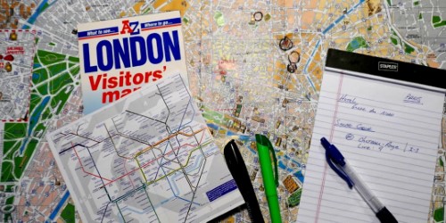
Although maps can be
accessed online and can even be customized as
described on our other pages, we are limited by
the size and detail that can easily be displayed
on computers and mobile devices. Having a
large map such as the one shown below will
greatly assist you with the planning process and
organization of your activities. Physical
maps can easily be taken with you providing an
overall view of all your trip. ng an
overall view of all your trip. ding an
overall view of all your trip. ng an
overall view of all your trip.
overall view of all your trip. ng an
overall view of all your trip.
overall view of all your trip.
 Having a large map in
front of you will give you a birds eye view of
the entire location allowing you to easily group
activities together and plan what you want to
accomplish in an area to optimize your time.
Having a large map in
front of you will give you a birds eye view of
the entire location allowing you to easily group
activities together and plan what you want to
accomplish in an area to optimize your time.
Mark your map to show the locations you plan to
visit such as hotels, tourist attractions, metro
tops, important streets, etc.
Write directly on your map, circle locations and
highlight streets to mark locations.
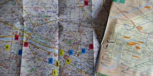
Use Transparent Post-it
Tabs to mark map locations. Number the
tabs to correspond with your notes showing the
location and subway lines/stops helping with
your navigation.
Even if you have found a
map online or have purchased a map, you may be
able to find a better and more
useful or detailed map upon your arrival.
Most major tourist locations will have
specialized maps listing tourist sites and
activities that you may not be able to find
online prior to your departure. It's also
a good idea to pick up a small pocket metro map
listing the subway lines and stops.
- Hotels should
provide you a free area map.
- Newsstands
should have maps available for a small fee.
- Subway and Bus
Stations should also have maps.
- Tourist
Information Centers should have free or
inexpensive maps.
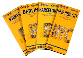 |
Borch Maps
http://borch.com/englisch/frame_neu/frameset.html
* Also available on Amazon
 Our city map of choice
This is a high quality, soft
folding laminated map.
Compared to the Lonely Planet
map of Paris shown below, it's
larger and slightly heavier but
is far more detailed, covering a much larger area of
Paris. In fact, the Lonely
Planet map cut off much of the
outer areas we were interested
in. The map also contains
a metro system map on the backside.
Borch uses a
patented lamination process to cross
the folds of the map, making it
easier to read and even easier to
refold. The tough but non-toxic
lamination material degrades to
oxygen and water in a landfill
environment. Before then, the map is
practically indestructible in your
backpack or suit coat pocket, and
can even be written on temporarily
with dry-erase markers.
-
Durable and waterproof
-
Easy-fold format and convenient size
-
Soft
Laminated
- Full color and easy-to-use
- Extensive street and site index
- Covers a
larger area of the city
- Detailed
- Dry
erase marker compatible
|
|
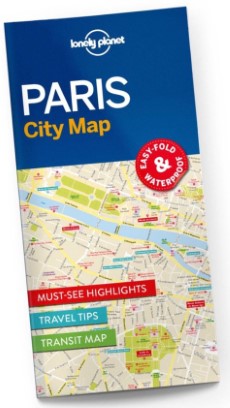 |
Lonely Planet
Maps
https://shop.lonelyplanet.com/categories/maps
* Also available on Amazon
If you are
looking for a smaller lite weight
map, this is a good choice but keep
in mind that it lacks the detail and
coverage you will find in the same
map of Paris by Borch shown above. map of Paris by Borch shown above. map of Paris by Borch shown above. map of Paris by Borch shown above.
The map also contains a metro system
map on the backside that is large
and easy to read.
Their maps are durable and waterproof. City maps
come in an easy-fold design held
inside a handy slipcase. Detailed
and easy-to-read, they’re printed in
full color to make travelling and
trip planning a breeze. Made for the
urban explorer, each map is packed
with top sights, expert advice, a
transport map and a useful street
index.
-
Durable and waterproof
-
Easy-fold format and convenient size
-
Handy slipcase
-
Full color and easy-to-use
-
Extensive street and site index
-
Images and information about top city attractions
-
Handy transport map
-
Practical travel tips and directory
-
Itinerary suggestions
|
|